

 Image copyright
Getty Images
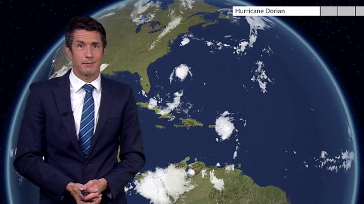
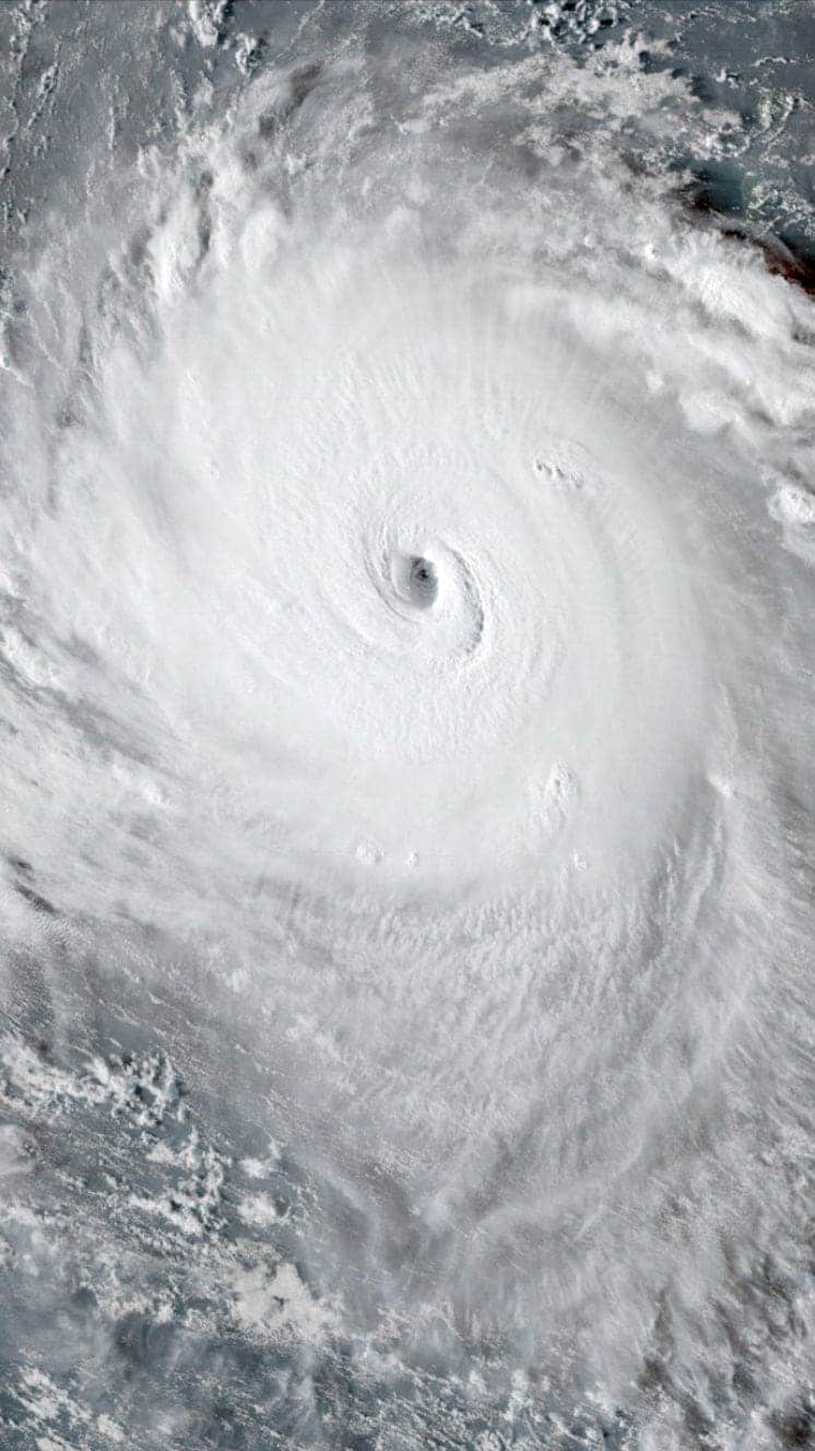
Hurricane Dorian is expected to strengthen into an “extremely dangerous” storm as it heads towards the US mainland, the National Hurricane Center (NHC) has warned.
Dorian is currently a category one hurricane, but could be category four by the time it reaches the mainland.
The storm is expected to hit somewhere between Florida and southern Georgia, possibly late on Sunday, the NHC says.
Florida’s Governor Ron DeSantis has already declared a state of emergency.
He told residents it was “important for Floridians on the East Coast to monitor this storm closely”, advising them to stock up on at least seven days worth of food.
The NHC noted the risk of “devastating hurricane force winds along the Florida East Coast” in its latest advisory.
A spokesman told news agency Reuters that winds were expected to reach 130mph (210km/h) over the weekend – making it a category four storm.
On the Saffir-Simpson scale, a category four storm is the second strongest, capable of causing “catastrophic damage”.
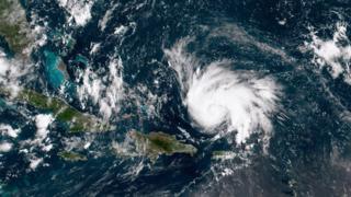
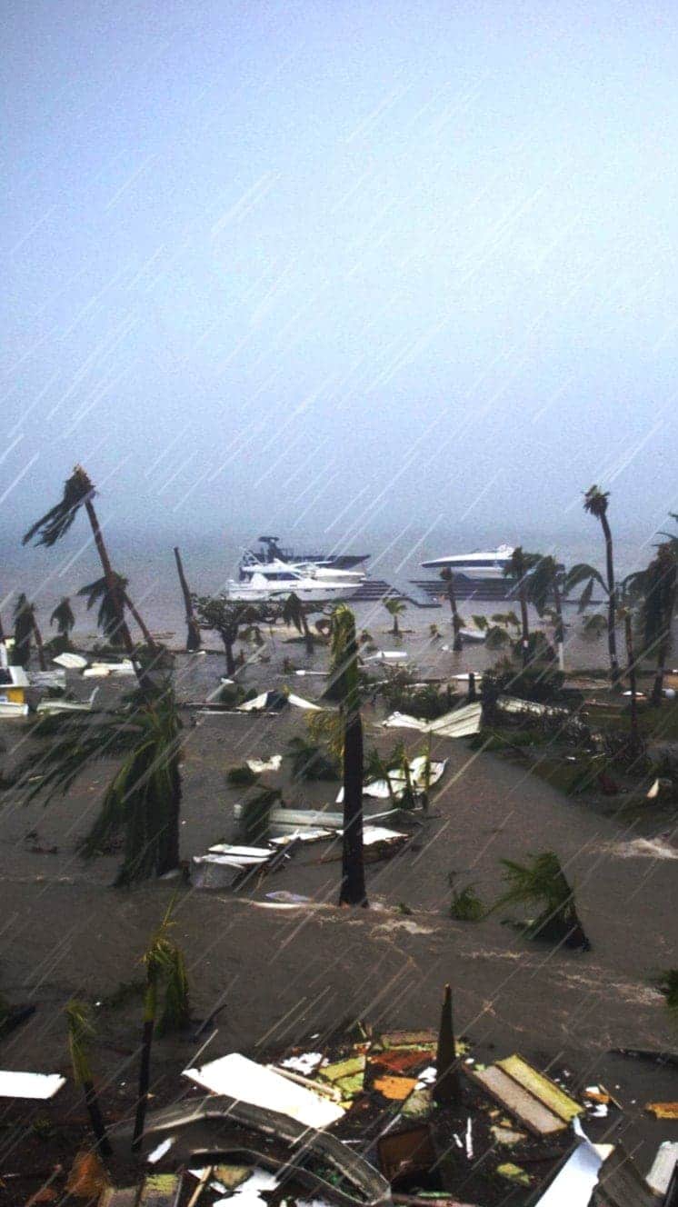
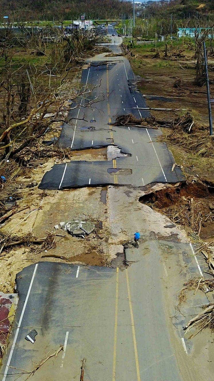
The warnings come after the eye of the storm missed the main island of Puerto Rico, sparing it significant damage, as it headed north-west on Thursday.
What’s the forecast?
As of Thursday morning, the storm was packing winds of 85mph and has been predicted to bring up to 12in (30cm) of rain when it reaches land. It is currently some 220 miles (355km) north of Puerto Rico’s capital, San Juan.
Dorian grazed the edge of the main island of Puerto Rico but the US territory’s smaller islands, Vieques and Culetra, have been battered by heavy rain and high winds.
On Wednesday, wind gusts of 111mph were reported close to St Thomas in the US Virgin Islands, just east of Puerto Rico.
The NHC expects Dorian – which is travelling in a north-westerly direction at about 13mph – to reach major hurricane status by Friday.
According to the latest update, it should pass “well east” of the south-eastern and central Bahamas on Friday, before moving over or near parts of the north-western Bahamas on Sunday.
Forecasters have warned of life-threatening flash flooding and rip-current conditions as the storm moves across the region.
Hurricanes
A guide to the world’s deadliest storms
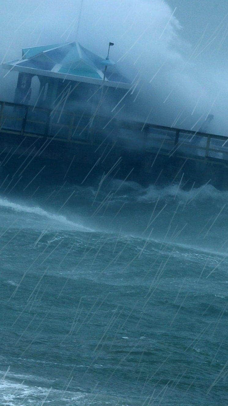
Hurricanes are violent storms that can bring devastation to coastal areas, threatening lives, homes and businesses.

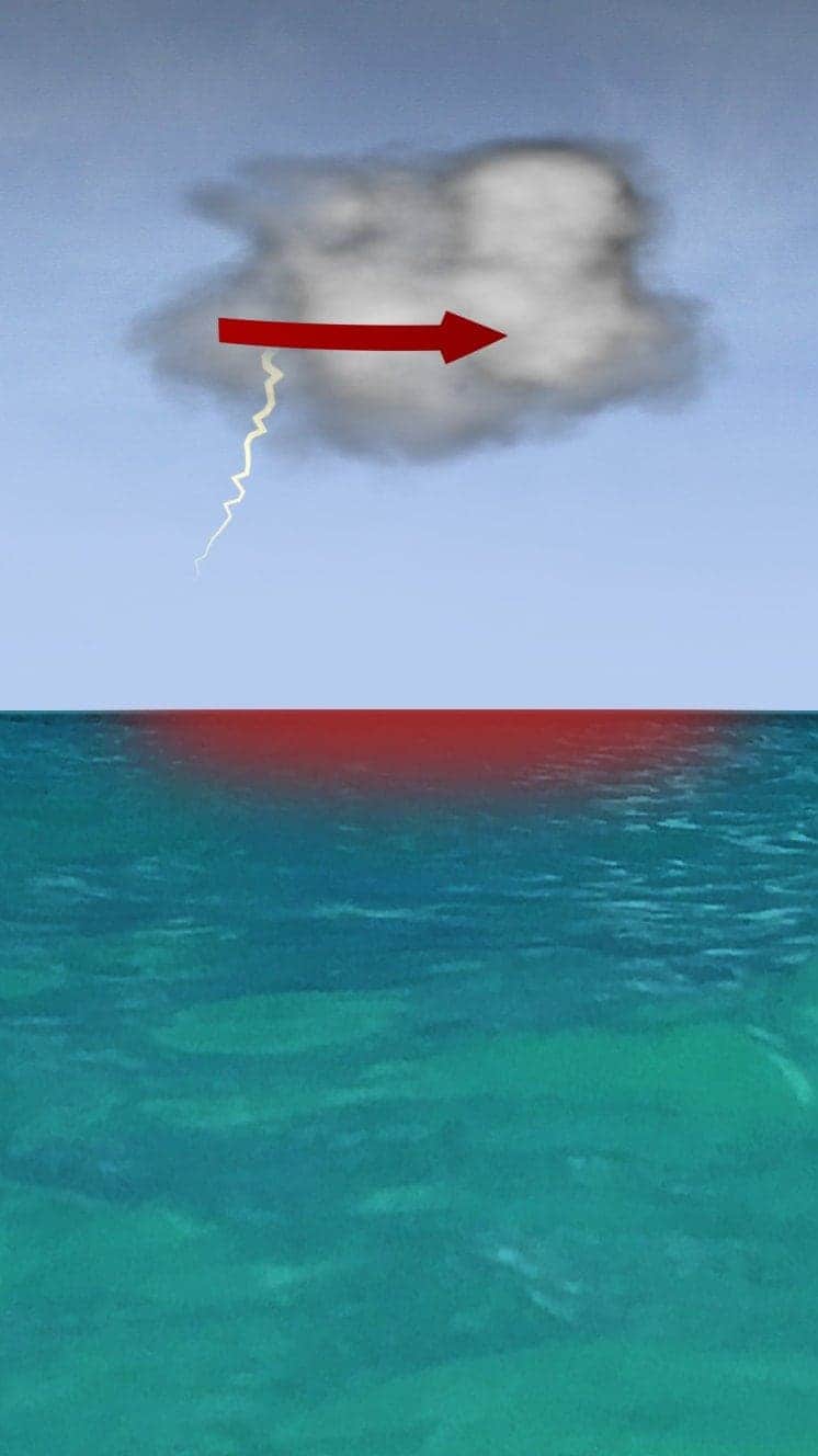
Hurricanes develop from thunderstorms, fuelled by warm, moist air as they cross sub-tropical waters.
Warm air rises into the storm.
Air swirls in to fill the low pressure in the storm, sucking air in and upwards, reinforcing the low pressure.
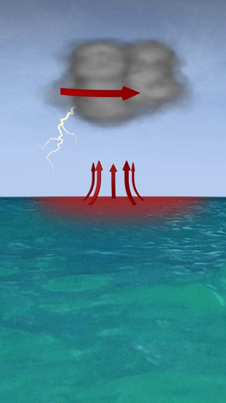
The storm rotates due to the spin of the earth and energy from the warm ocean increases wind speeds as it builds.
When winds reach 119km/h (74mph), it is known as a hurricane – in the Atlantic and Eastern Pacific – or a typhoon in the Western Pacific.

“Everybody has a plan until they get punched in the face. Well, we’re about to get punched in the face.”
Florida Mayor Bob Buckhorn, ahead of Hurricane Irma (2017)
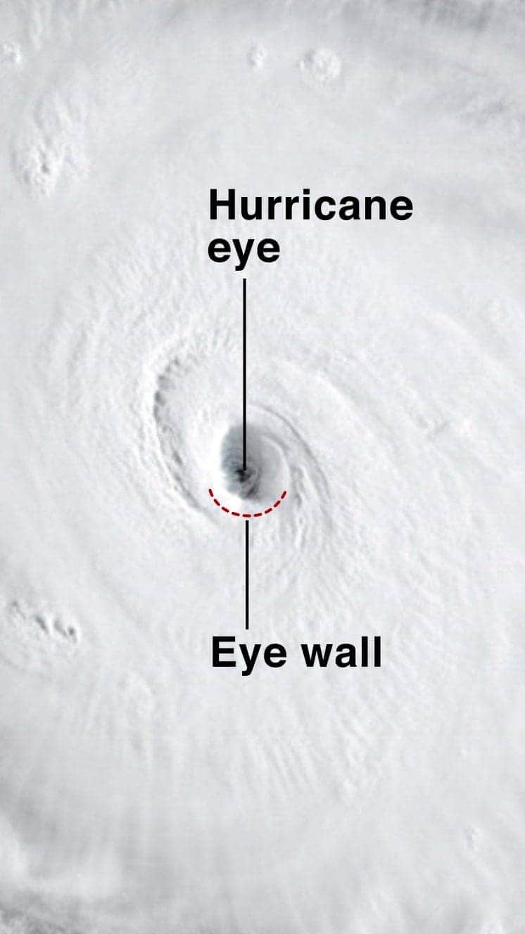
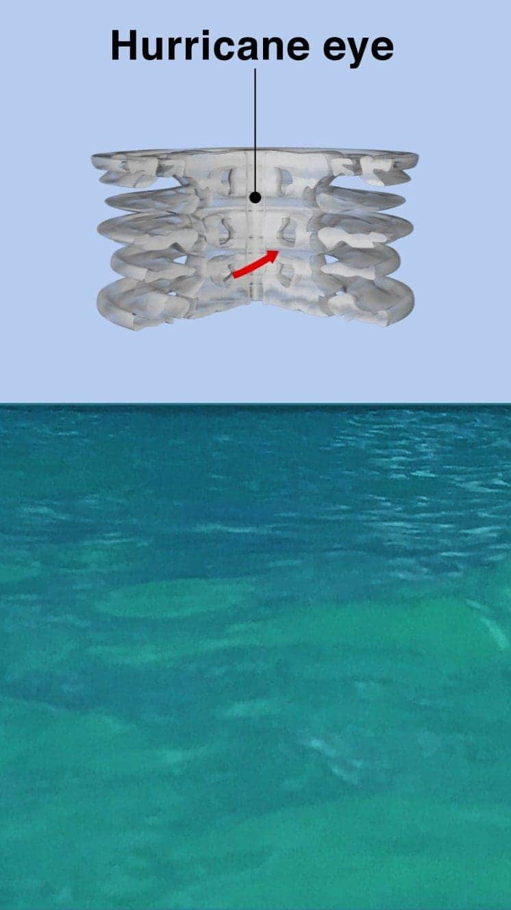
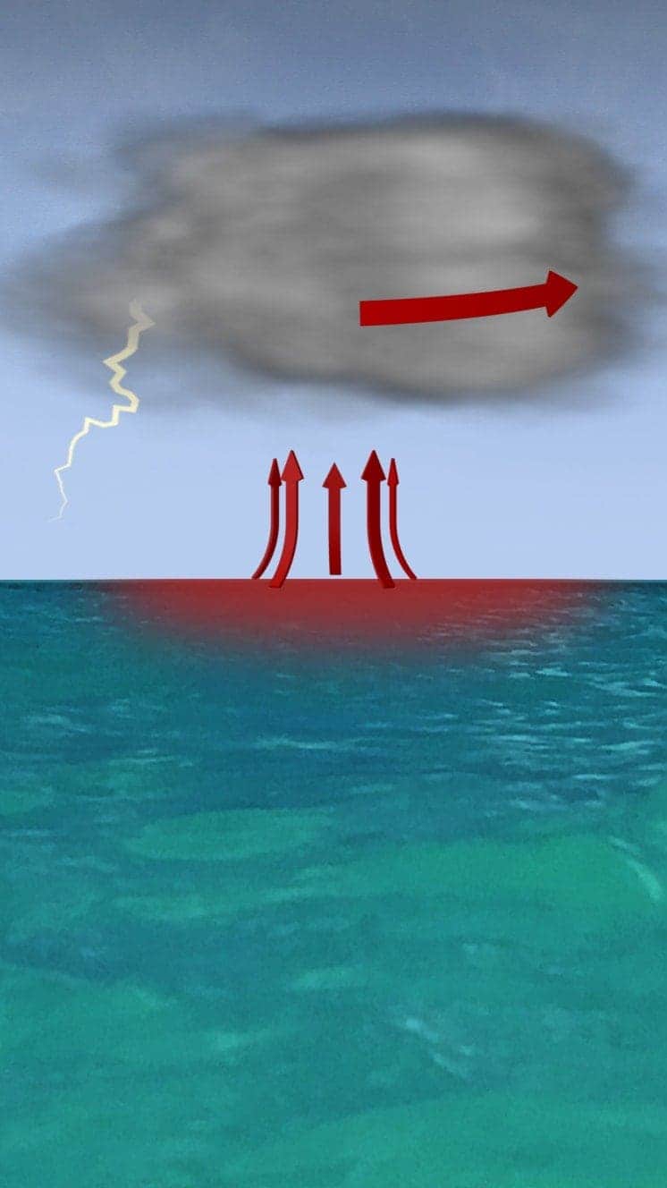
The central eye of calmer weather is surrounded by a wall of rainstorms.
This eyewall has the fastest winds below it and violent currents of air rising through it.
A mound of water piles up below the eye which is unleashed as the storm reaches land.
These storm surges can cause more damage from flooding than the winds.

“Urgent warning about the rapid rise of water on the SW FL coast with the passage of #Irma’s eye. MOVE AWAY FROM THE WATER!”
Tweet from the National Hurricane Center
The size of hurricanes is mainly measured by the Saffir-Simpson scale – other scales are used in Asia Pacific and Australia.
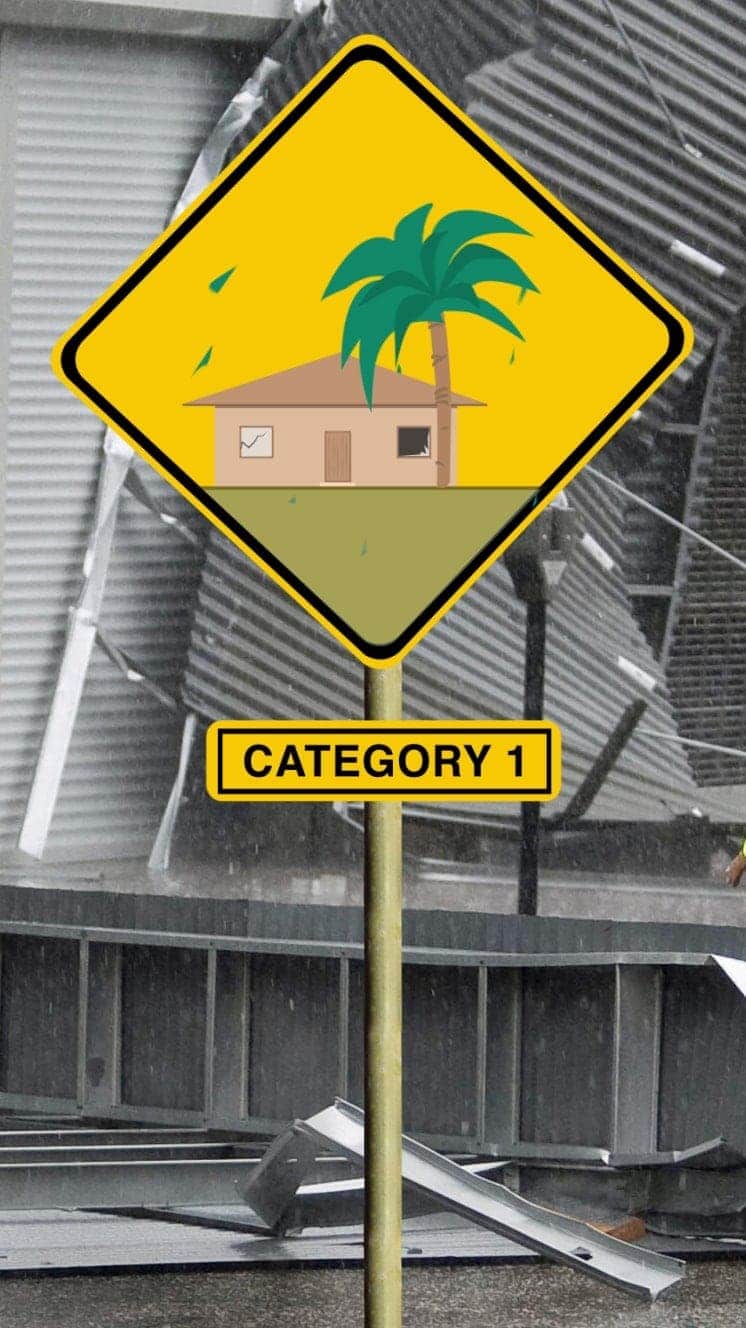
Winds 119-153km/h
Some minor flooding, little structural damage.
Storm surge +1.2m-1.5m
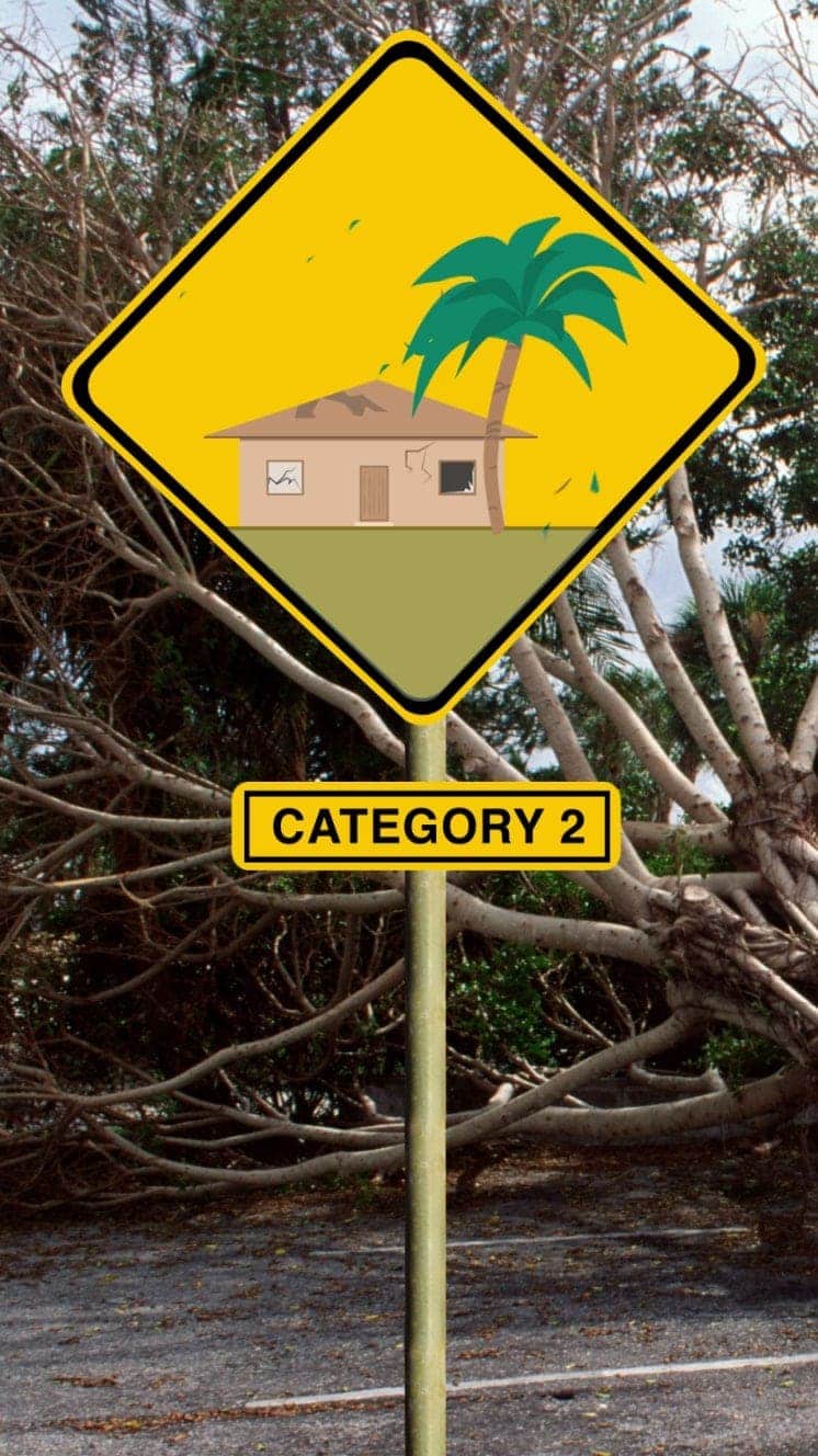
Winds 154-177km/h
Roofs and trees could be damaged.
Storm surge +1.8m-2.4m
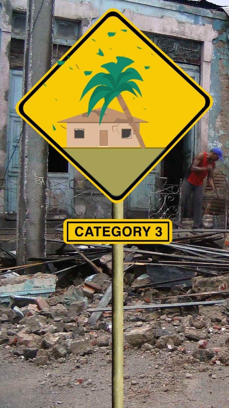
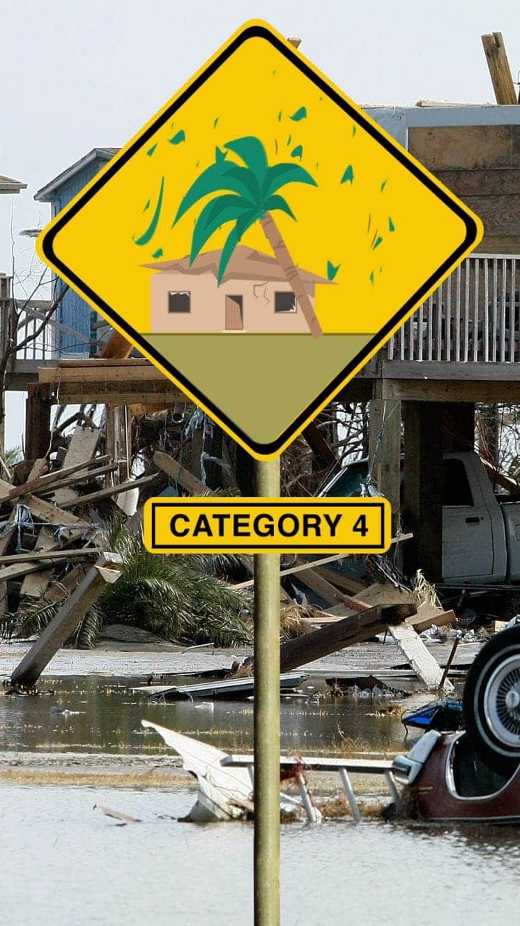
Winds 178-208km/h
Houses suffer damage, severe flooding
Storm surge +2.7m-3.7m
Hurricane Sandy (2012) caused $71bn damage in the Caribbean and New York
Winds 209-251km/h
Some roofs destroyed and major structural damage to houses.
Storm surge +4m-5.5m
Hurricane Ike (2008) hit Caribbean islands and Louisiana and was blamed for at least 195 deaths
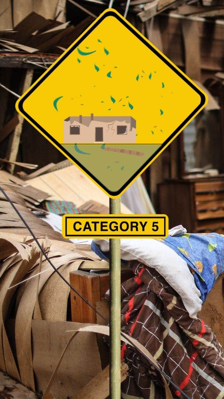
Winds 252km/h+
Serious damage to buildings, severe flooding further inland.
Storm surge +5.5m
Hurricane Irma (2017) caused devastation in Caribbean islands, leaving thousands homeless
“For everyone thinking they can ride this storm out, I have news for you: that will be one of the biggest mistakes you can make in your life.”
Mayor of New Orleans Ray Nagin ahead of Hurricane Gustav, 2008
Hurricane Dorian: ‘Extremely dangerous’ storm bears down on Florida